Mapping with Drones
Drone Photography Services fly our drones (UAV’s) with a high-resolution camera to collect 20 megapixel aerial photographs for a wide variety of commercial photogrammetry mapping uses. We can measure and map hard to reach areas like, quarries, landfill sites and open cast mines.
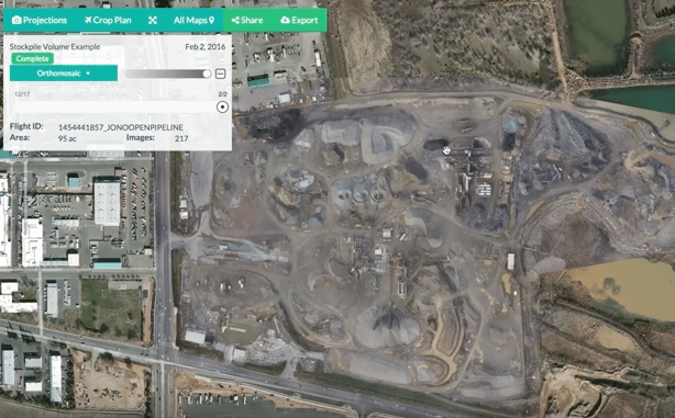
Depending on the client requirement, we use either PC based or cloud based drone mapping software suppliers Pix4D Mapper and DroneDeploy Pro to produce 2D photo-mosaics and 3D Digital Surface Models in the form of geo-referenced Orthomosaics, DSM, DEM, NDVI, and Point Clouds.
The processing and analysis of this aerial imaging data is done quickly on powerful servers to produce an accurate useable map in various file formats for our clients to use or to import into GIS, CAD compatible software – ArcGIS, Global Mapper, QuantiumGIS, AutoCAD, 3D Reshaper, Trimble, Quick Terrain Reader, Bentley and CC Viewer.
The higher altitude we fly, the more acres of land we can cover, but the lower we fly the more detailed the image. The standard maximum resolution of the images is 5cms per pixel but this can be increased to 1cm per pixel for an additional cost.
The flight altitude and image overlap is determined by the type of industry and the results required. We fly at a consistent height in a lawnmower path with the overlap of images normally set at 75-80% for most jobs.
2D orthophotography can be used to measure real distances, because it is an accurate representation of the Earth’s geographic surface. The overlapping geo-referenced aerial images are stitched together in the software to produce a 2D Orthomosaic – 2D photo-mosaic.
Using this information combined with additional oblique side images taken at 30° and 45 ° angles the software can also produce a 3D model that can be viewed from any side or orientation. These 2D and 3D maps can be compared to older and newer versions to record change and calculate length, area, volume, cut/fill, and elevation between two or more dates.
Below are some current industry sectors and applications for drone flights to collect images for 2D photo-mosaics and 3D Digital Surface Models:
| Industry Sectors | Applications |
| Agriculture | Crop Stress / NIR / NDVI |
| Construction | Topography |
| Oil & Gas | Volume calculation – surface and piles |
| Solar Power | As built drawings |
| Wind Turbines | Corridor mapping and monitoring |
| Electric Power | Power line monitoring |
| Mining | Erosion monitoring |
| Waste management | Flood monitoring and management |
| Environmental | Wildlife Management |
| Landfill | Cut /Fill mapping |
| Public Agencies | Research |
| Disaster management | Disaster response / fire monitoring |
| Surveying | Planning |
| Safety assessment | Law enforcement |
| Insurance | Change detection |
| Engineering | Maintenance monitoring |
Our drone data is up to date and more detailed that satellite data collected from Google Earth or Google Maps.
For land and mining applications 2D photo-mosaics and 3D Digital Surface Models are becoming an integral part of the day to day operations, progress monitoring and volume measurement of materials.
3D Digital Surface Models show the topography and the exact landscape contours.
In Japan since 2017 earthmoving equipment manufacturer’s are using drone imagery coupled with powerful 3D models to operate unmanned digging equipment on experimental land cut and fill sites.