Coastal Erosion Surveys and Inspection
All of our pilots are skilled in flying aerial survey drones to get a view of those “difficult to reach” places. We can fly our drones close to the cliffs to get detailed aerial camera ultra-HD 4K video footage or up to 48 megapixel still aerial images.
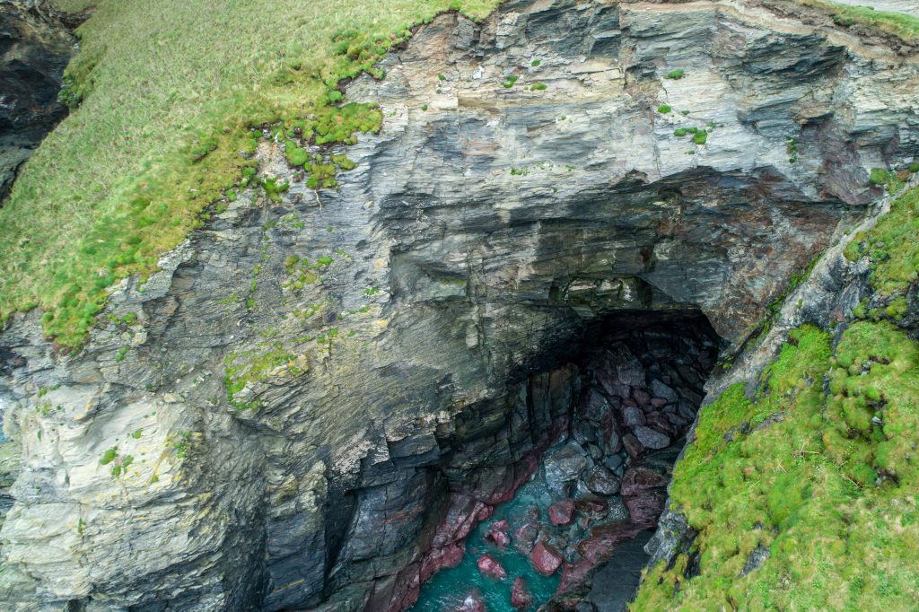
The coastline can be subject to extreme weather conditions safe access be a concern.The image below from a drone survey established the extent of the erosion and how the sea was affecting the dawn.
Cost Effective Coastal Surveys
We offer a very cost effective, quick solution for Coastal Erosion Surveys and Inspection compared to more expensive traditional methods of hiring climbers to scale down or abseil down the cliffs.
No one leaves the ground so it is also extremely safe.
This is very useful if the rock structure is unsound or has difficult or complex access. We were able to fly the drones down below cliff level, down to sea level from ground level.
Our clients can join us to monitor the footage on the ground in real-time.
All of the coastal cliff images were sent to the client to view on their laptop, tablet or PC and keep for future analysis, reference and comparison.